
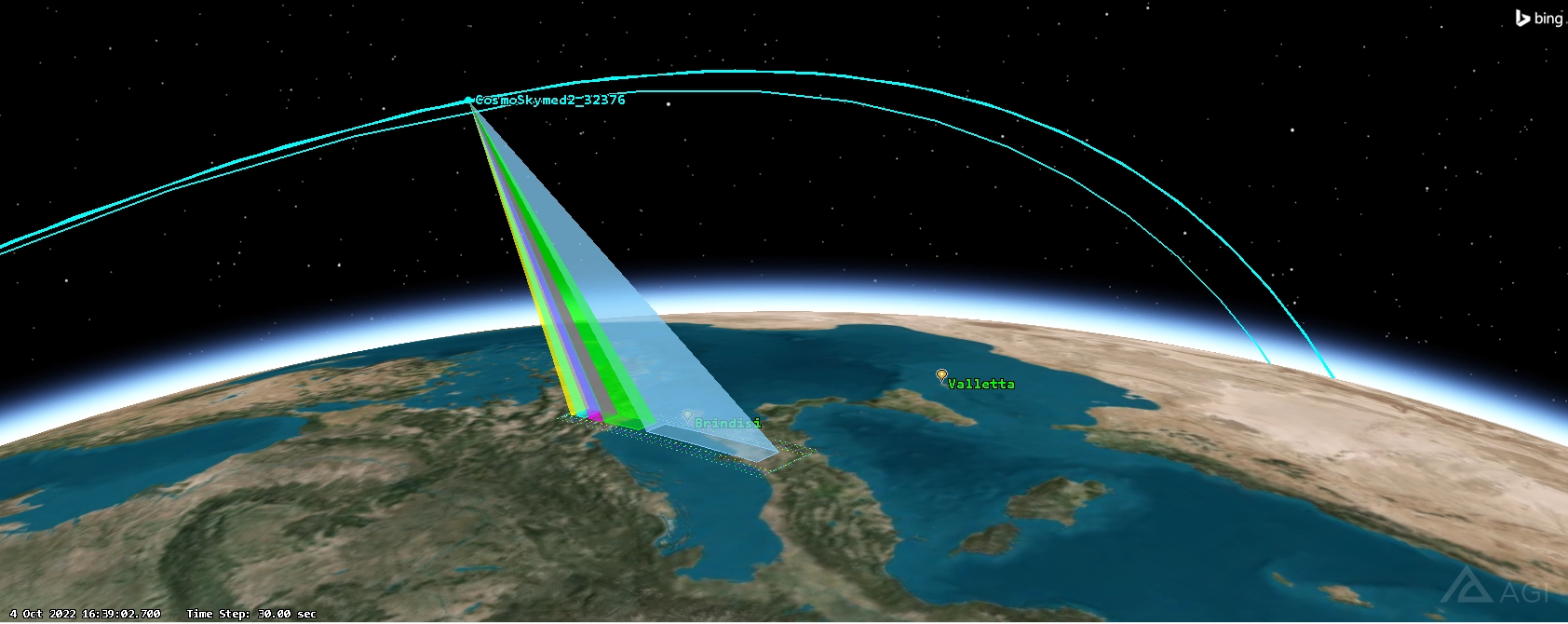
Satellite Imaging Forecast
Find the right window to acquire the right image
GSIF is the GMSPAZIO tool designed to simplify work with Earth Observation satellites. It allows users to quickly identify which satellites, from a user-defined list, are capable of acquiring images over a specific area of interest.
In just a few steps, GSIF helps identify imaging opportunities, calculate revisit times, and generate useful outputs for planning requests to commercial or institutional providers.
System Introduction
Faster, clearer, and more predictable satellite acquisitions
When a satellite image is needed, the challenge isn’t just knowing what to observe. You need to understand which satellite can acquire the area, when it can do so, with which sensor, and under what operational constraints.
GSIF was created to simplify this process: it connects missions, orbits, sensors, and areas of interest in a single environment, helping the user quickly identify available opportunities.
The result is a useful tool for reducing analysis time, comparing options, and preparing more effective acquisition requests.
Acquisition Planning
Imaging Request Management
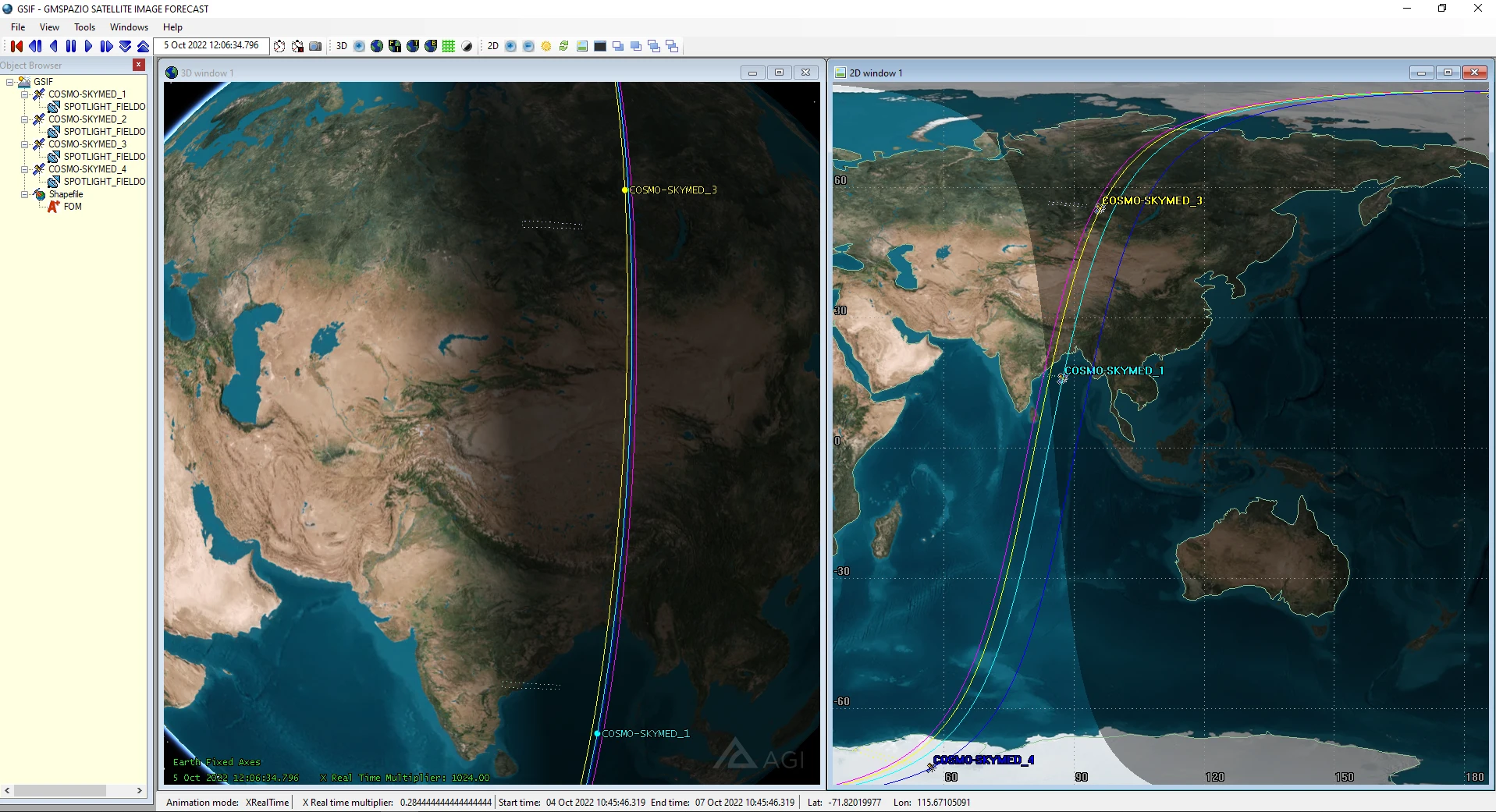
GSIF supports the planning of satellite acquisitions on single targets or user-defined target lists.
The tool allows for the calculation of the first available imaging opportunity and the revisit time, helping to understand when a specific area can be observed again.
This makes it easier to evaluate different missions, compare time windows, and interact with satellite imagery providers using more precise information.
<p>Calculation of the first useful acquisition window for a target or a list of targets.</p>
</p>
<p>
Database and Parameters
Mission and Sensor Catalog
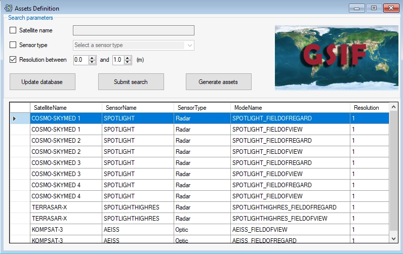
GSIF utilizes a database of satellite missions and sensor parameters to evaluate acquisition opportunities.
The database can include information on satellite name, mission provider, sensor, sensor type, model, resolution, and other parameters useful for evaluation.
Orbital data is updated from international databases and saved locally to propagate satellite positions over time and evaluate available acquisition windows.
Output
Coverage and Availability Assessment
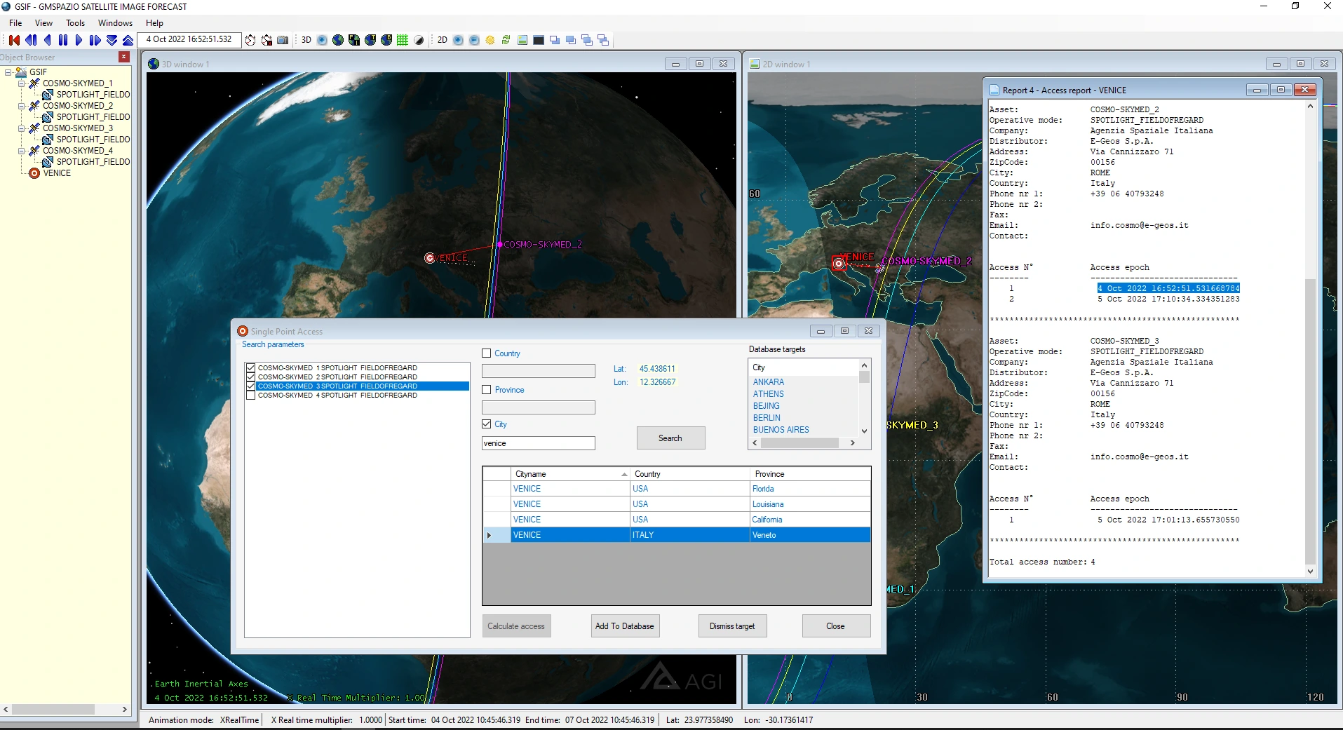
GSIF transforms imaging requests into clear, actionable results. The outputs allow users to understand which satellites can observe the requested area, when they are available, and which acquisition windows are most favorable.
Results can be viewed on 2D maps, 3D environments, and exportable reports for further analysis or sharing with partners and providers.
Main Outputs
Among the main outputs, GSIF identifies available acquisition windows, the first imaging opportunity, and the revisit time, highlighting satellites and sensors compatible with the requested area.
Results can be consulted through 2D and 3D visualizations and exported into reports for subsequent analysis or sharing. The platform also supports the preparation of requests to be forwarded to satellite imagery providers.
Related Services
Specialized Support
GSIF can be adapted to specific user needs, integrating custom missions, databases, workflows, and outputs.
GMSPAZIO supports clients and partners in tool configuration, defining imaging requirements, and integration with existing operational processes.
The value is not just in finding an acquisition window. It is in transforming an observation request into a faster, traceable, and more readable process.

Request an operational demo
Find the image you need, faster.
