GARA is a solution dedicated to Mission Simulation focusing on Radar Performance and Detection, designed as a software tool integrating the functionality of the AGI STK (AGI Systems Tool Kit) products and the features specially made by GMSPAZIO, that offers GARA under Windows 10 operative system (64 bit).
GARA is a powerful tool that allows us to evaluate the capabilities of radar to perform advanced aircraft detection and a real-time simulation in a 3D modeling environment.
The analysis takes into account the attenuation of the radar signal (due to the distance from the target, atmosphere absorption, and scattering from the terrain), the radars and jammers specs, and the RCS characterization of the target, producing a set of reports and graphs that show the values obtained in the 3D graphics window.
GARA’s software GUI is articulated in 2D and 3D interfaces to start complex simulations evaluating their performances through a wide range of reports and graphs, exportable into Microsoft Excel file format.
GARA offers the following features:
Scenario Definition: Environment and Simulation Time
Several environmental factors can affect the performance of a communications link or a radar system. The Environment configuration tool enables the user to apply the following models to your analyses: Environmental Data; Rain, Cloud, and Fog; Atmospheric Absorption.
Aircraft mission configurations
With the Aircraft configuration tool, the user can define an aircraft object from Waypoints or Ephemeris and Attitude files.
In both cases, the altitude is measured using mean sea level (MSL) as the reference datum, and it is possible to load a 3D model from a .dae or .mdl file.
RCS characterization
The Radar Cross Section (RCS) is defined as the projected area of a metal sphere that would return the same echo signal as the target if it were substituted for the target. The user can add the RCS of an aircraft after creating a scenario and adding an aircraft.
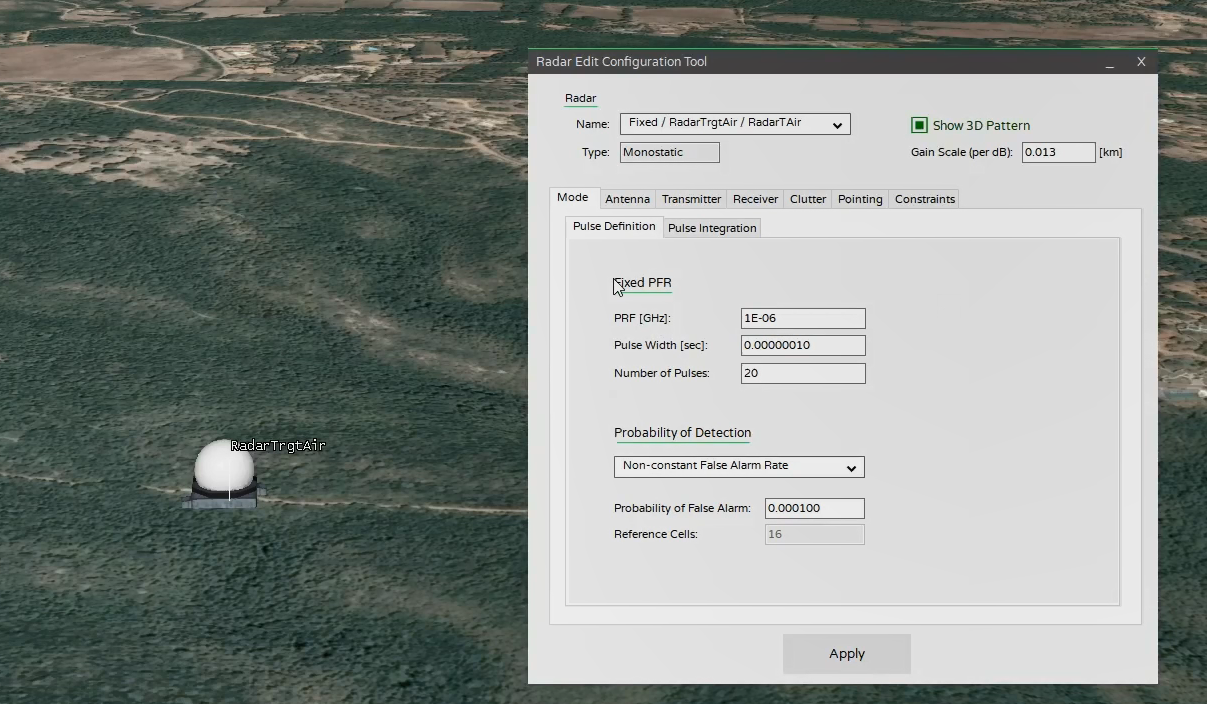
Radar features and position
With the Radar configuration tool, the user can define a radar object attached to a ground station or an aircraft. The radar object is a monostatic radar (which uses a standard antenna for transmitting and receiving) in search/track mode to detect and track point targets. The signal return from a point target is inversely proportional to the fourth power of the target range and directly proportional to the target’s radar cross section (RCS). Real targets have widely differing radar cross-sections from different aspect angles.
Perform assessment: Reports and Graphs
With the Report configuration tool, the user can perform, between an aircraft and a radar, the following reports:
Radar Antenna: provides an output regarding the Antenna coordinate system, azimuth, Elevation, and gain as functions of time.
Radar Environment: provides an output regarding Free Space, Atmospheric, Rain, and Cloud/Fog Attenuation and Received Isotropic Power (RIP) as functions of time.
Radar Geometry: provides an output regarding Range, Range Rate, Target Incident azimuth, and Elevation as functions of time.
Radar RCS provides an output regarding RCS and RCS CrossPol.
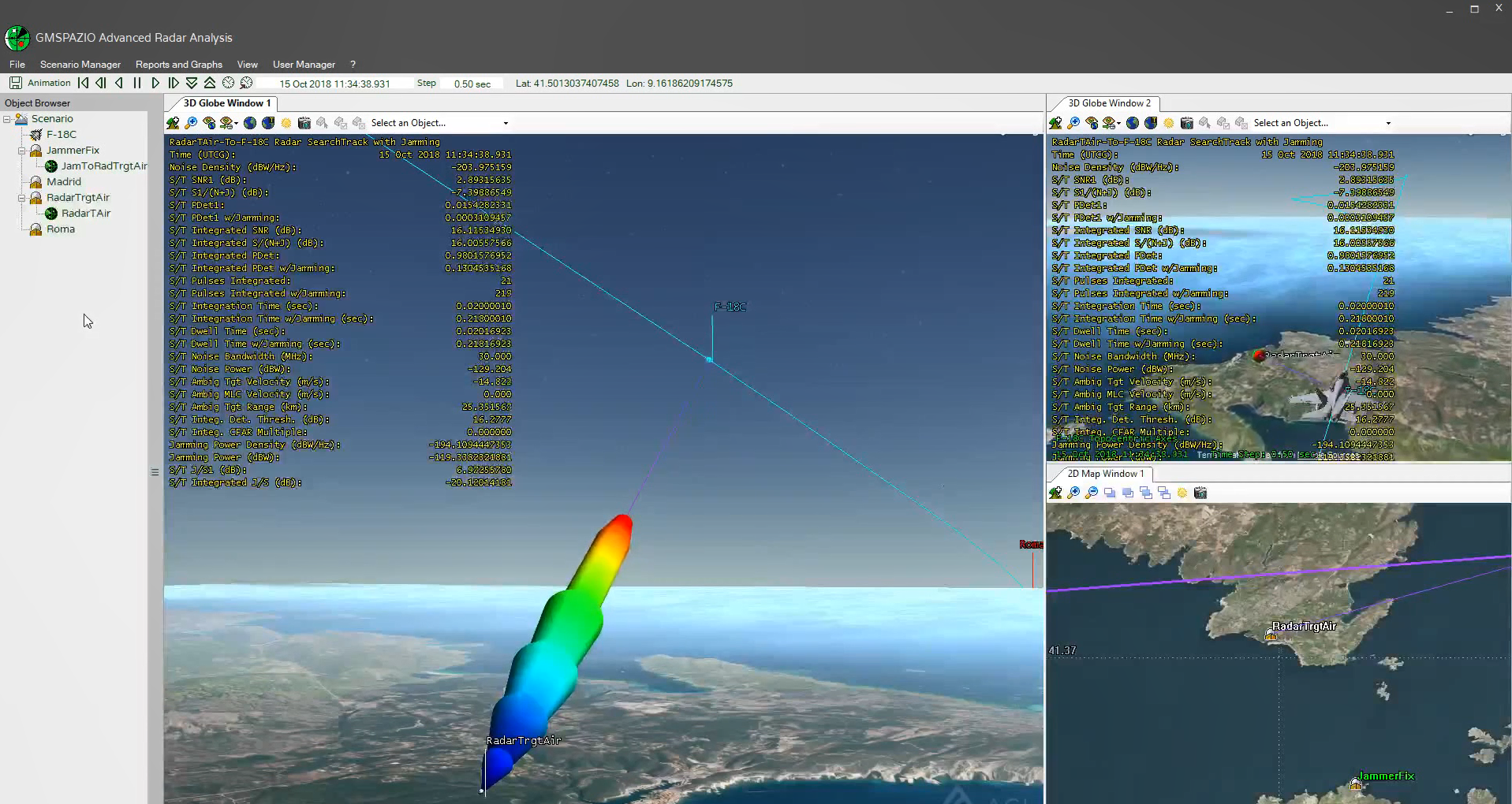
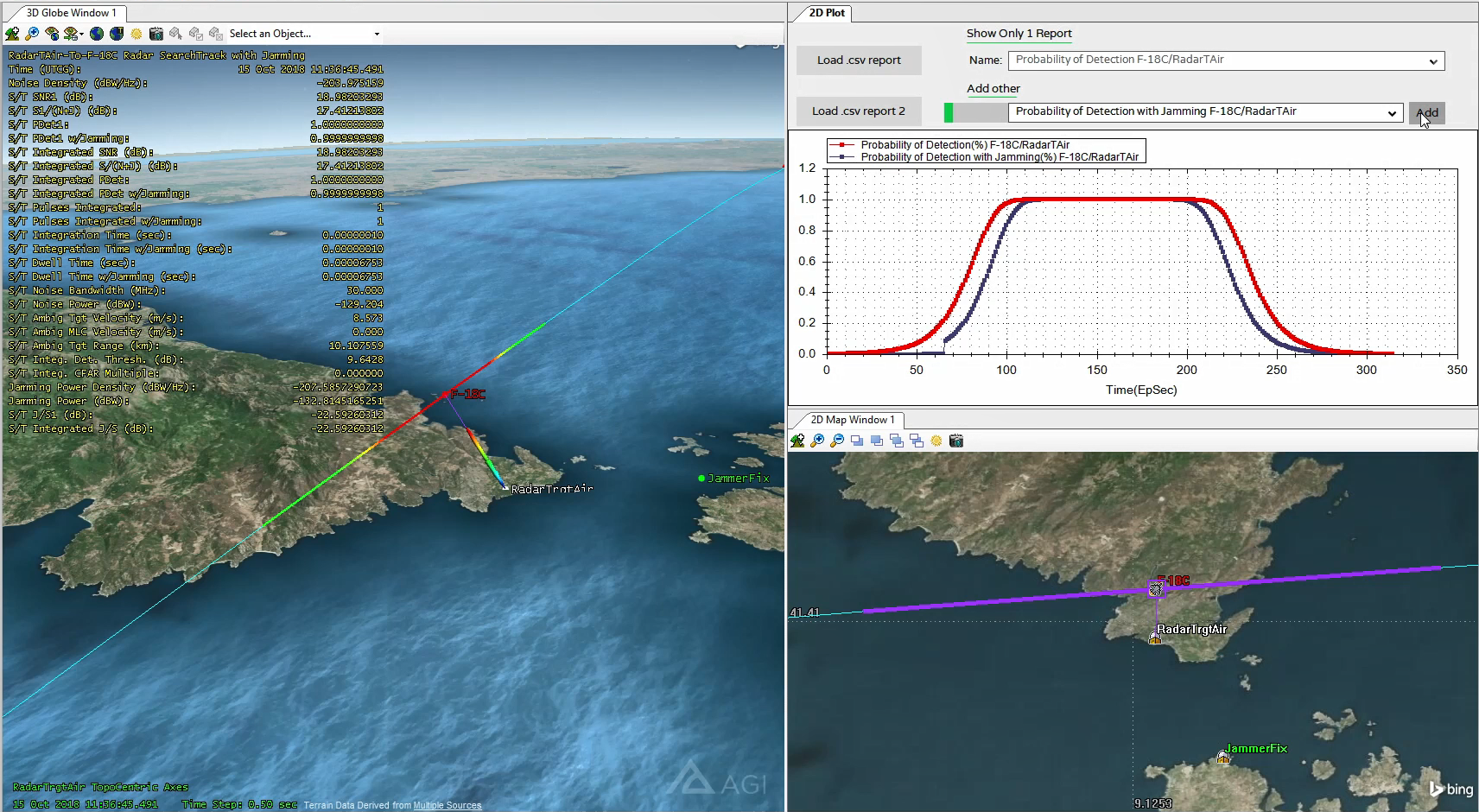
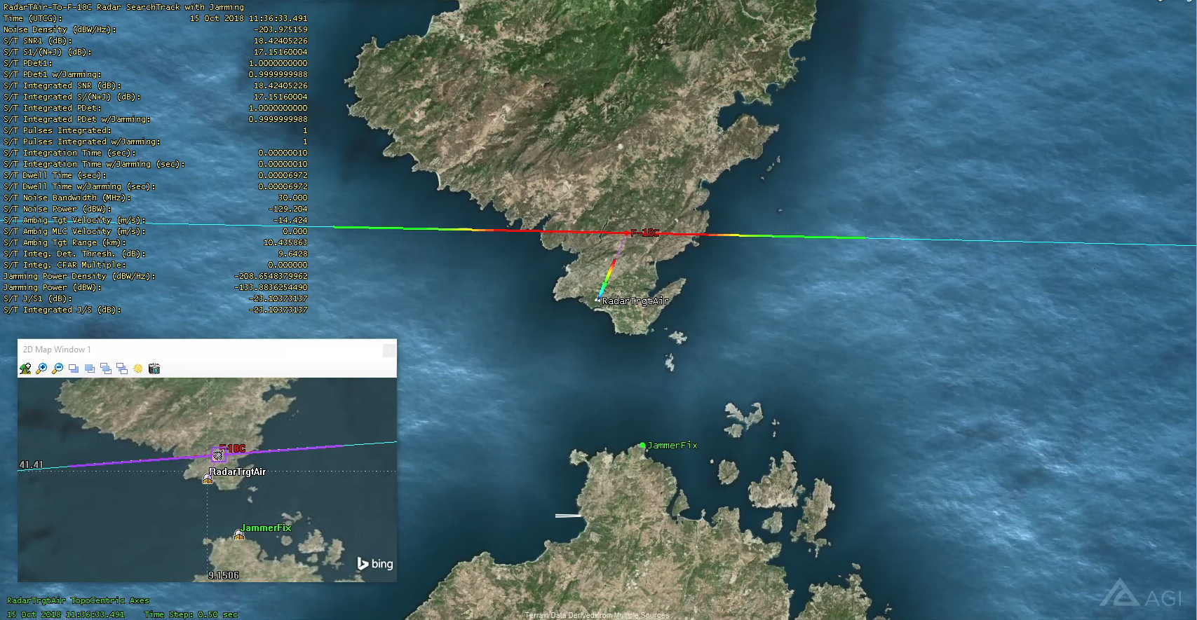
Radar SearchTrack: provides an output regarding Single-Pulse Signal to Noise Ratio, Probability of Detection, Probability of Detection with Jamming, Integrated SNR, Pulses Integrated, Integration Time, Dwell Time, Noise Power, Jamming power, J/S1, and Integrated J/S.
All reports VS Single Time.
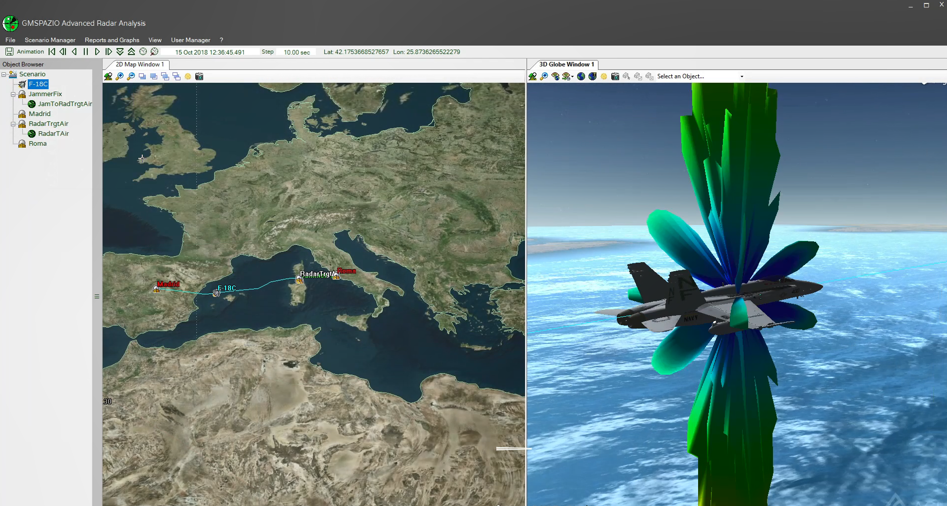
Visualization of reports in the 3D graphic window
The user can display a report in the 3D graphic window that changes during the animation time, and with the Single Object Coverage configuration tool, he can compute, between an aircraft and a radar, a coverage, using Probability of Detection or Probability of Detection with Jamming as constraints. These features are handy for having a further visual estimate of what can be read from the report or the graphs.
Import of Objects and Terrain Data
With the Object Browser opened, the user can explore different functions for each object in the scenario and, in particular, can import aircraft, ground stations, and radars from a file.
Instead, the user can load terrain imageries from the 3D Globe Window and the 2D Map window.
GARA tool shall allow the user to optimize the radar capabilities to obtain the maximum detection probability of an aircraft computed in a given trajectory and a defined scenario, employing parametric analysis.
GARA can also generate a complex scenario in which some values or realizations of the parameters of interest for the detection probability computation are specified in advance so that they can be modified during the analysis to take into account a set of possible input data.