GSIF is a toolset aimed to offer end-users the possibility to know immediately which satellite, one or a constellation of them, from a predefined user’s list, is/can image an user area of interest.
With a few clicks the end-user can get:
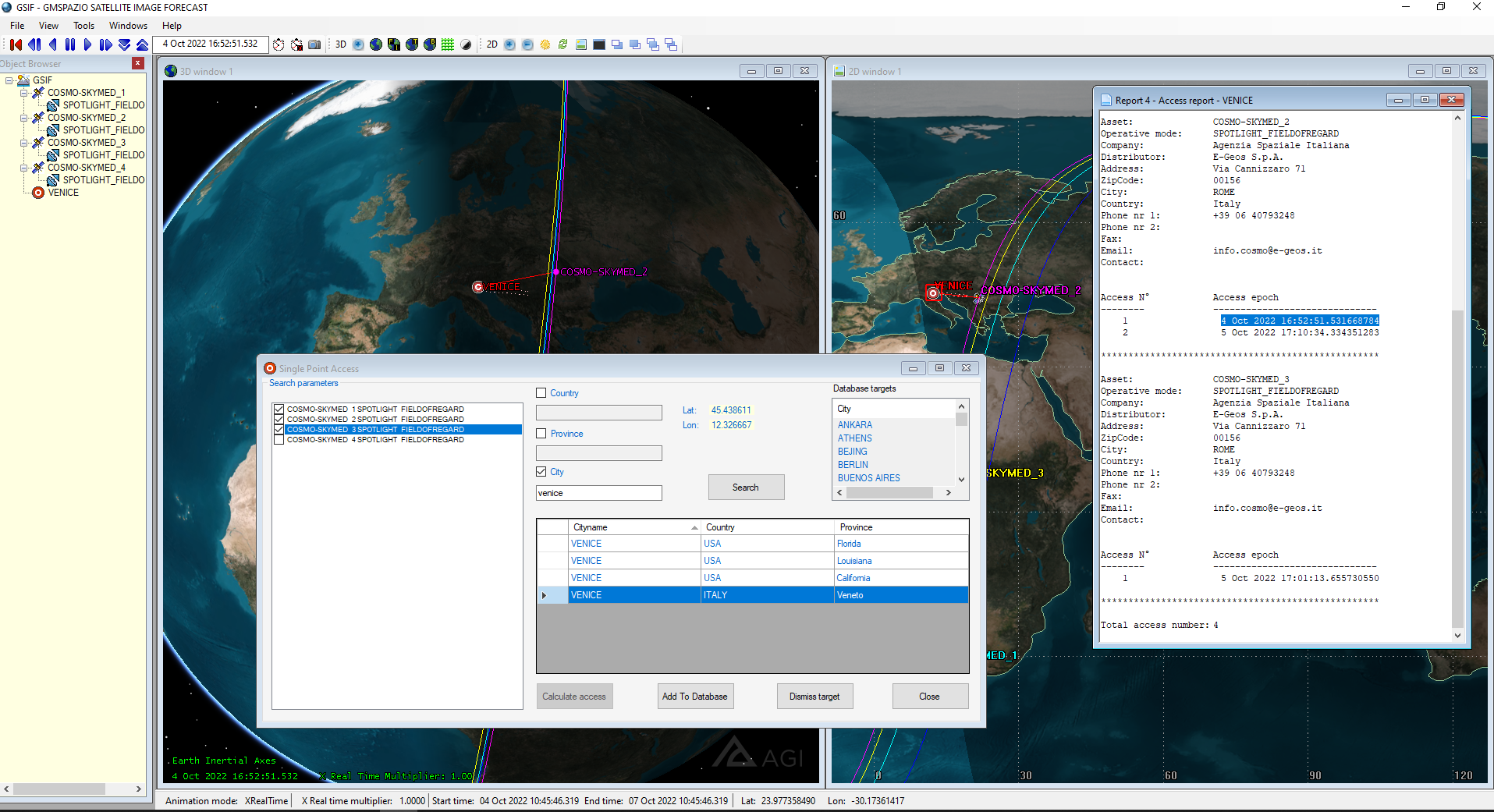
First Imaging Function: calculates the first available opportunity of imaging for a user-defined target or a list of them
Revisit Time Function: calculates the revisit time for a user-defined target or a list of them
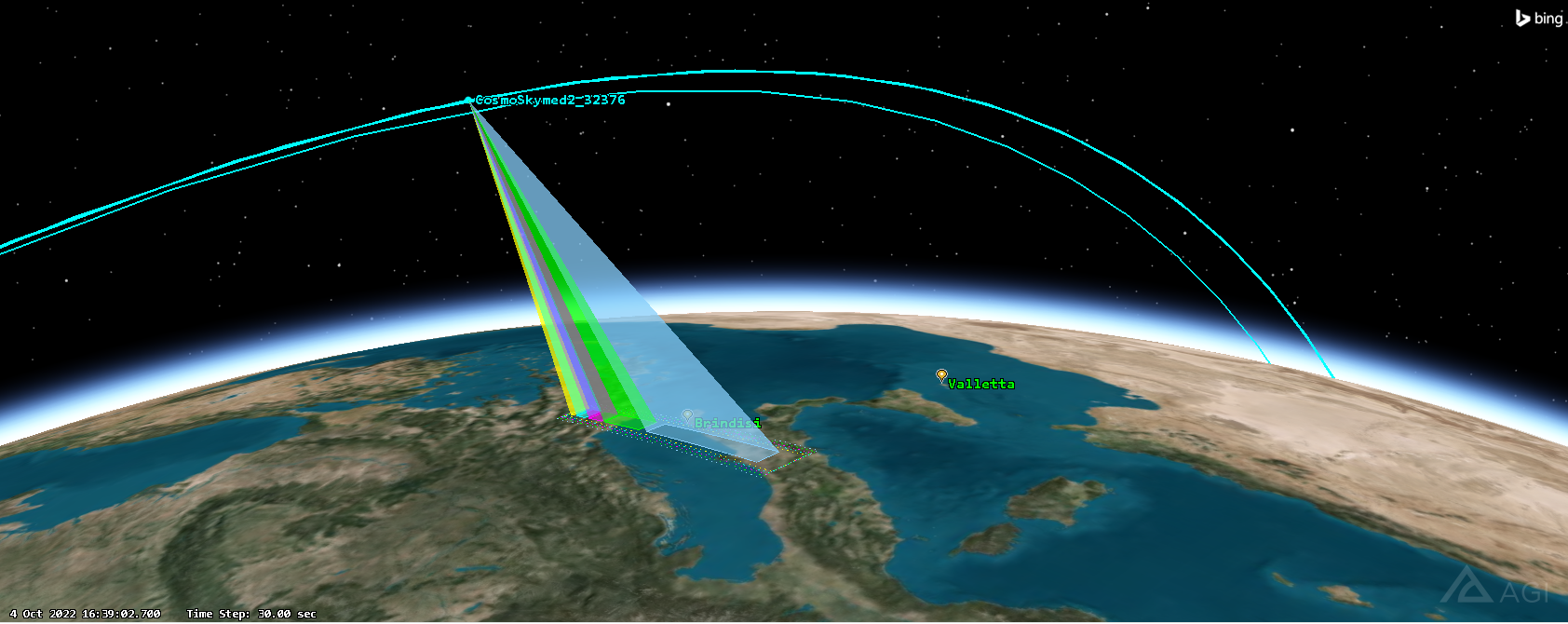
Satellite acquisition capabilities are fully evaluated, also in the presence of tiltable satellites (satellites able to point their cameras to acquire a side target), this is obtained by introducing the concept of Real sensor swath width, inside a Virtual satellite acquisition capability, as shown in the right picture.
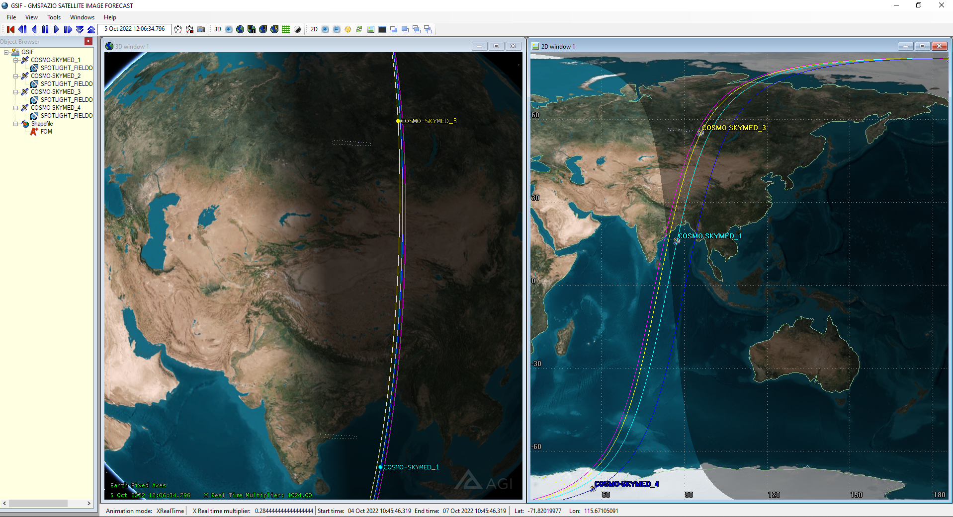
Built mainly upon one of the leading simulation engines, it features the same advanced 2D and 3D interfaces and it’s fully compatible with OpenGL standards.
GSIF provides information related to remote sensing satellite missions of user interests using a preloaded satellite database which also contains the specification of satellite sensors as per the following parameters:
Satellite name
Mission provider
Sensor name
Sensor type (Optical/Radar)
Model name
Resolution (Ground Sample Distance)
And much more…
This feature, together with the capability to evaluate many mission results simultaneously, offers the end user the capability to interact better with satellite image providers to produce reliable answers in a very short time.
Users may modify the database by inserting new missions/satellites or deleting existing ones. GSIF shows the results of the query into 2D and 3D maps plus in report format available to be exported for further usage.
Last but not least GSIF can be fully customized to fit any further user’s needs.